

Urban Fires
Tackle urban fire emergencies with drone thermal readings; improve your response efforts by localizing hotspots and deploying teams more effectively.
Urban Fires
Tackle urban fire emergencies with drone thermal readings; improve your response efforts by localizing hotspots and deploying teams more effectively.
Painpoints
- Firefighters often have little information about the complexity of the situation before entering a structure.
- Information exchange between fire brigades is often inefficient, hindering the effectiveness of the fire response and the chances of early mitigation.
- Main fire sources might be hidden under debris, smoke, or flames, making it difficult to identify and extinguish them.
Advantages
- Assess the severity of the incident in real-time and deploy teams to focus on the major sources of fire.
- Monitor the fire incident with a thermal aerial perspective to better coordinate the response and strategically deploy fire brigades.
- Thermal drone imagery can detect different fire sources and their respective temperatures.
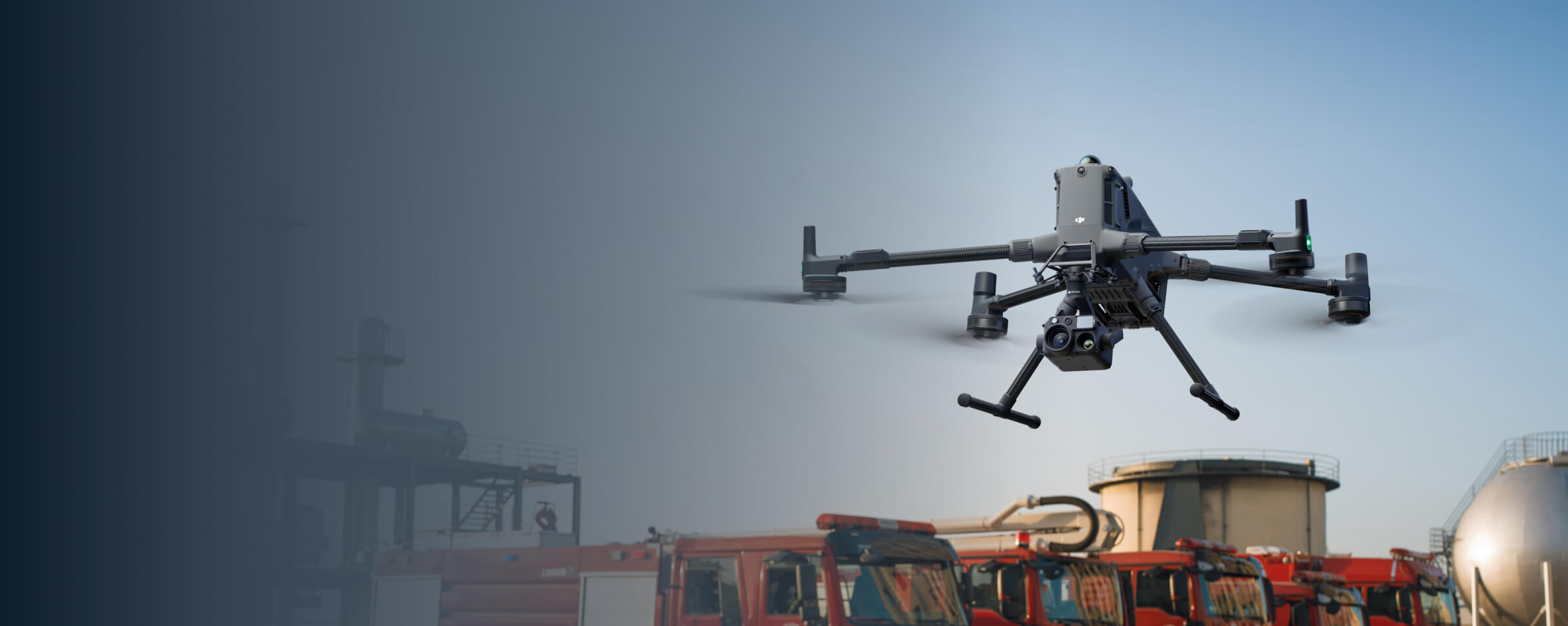
The Matrice 4T offers unparalleled portability for quick deployment missions. Easy to carry on fire response vehicles and equipped with visual and thermal cameras, it's the ideal solution for initial risk evaluations.
- Compact and lightweight design, around 1.2 kg and easy to carry in the response vehicle.
-
Fast and easy deployment, get airborne in around 30 seconds.
-
640 × 512 thermal radiometric sensor for accurate temperature readings.
-
Thermal palettes and temperature measurement tools for easy data interpretation.
The Matrice 4T offers unparalleled portability for quick deployment missions. Easy to carry on fire response vehicles and equipped with visual and thermal cameras, it's the ideal solution for initial risk evaluations.
- Compact and lightweight design, around 1.2 kg and easy to carry in the response vehicle.
-
Fast and easy deployment, get airborne in around 30 seconds.
-
640 × 512 thermal radiometric sensor for accurate temperature readings.
-
Thermal palettes and temperature measurement tools for easy data interpretation.
Drone Platform
DJI Matrice 4T
Weight: 1219 g (with propellers)
Max Flight Time (without wind): 49 minutes
Environment Adaptability: Max takeoff altitude 6000 m, max wind speed resistance 12 m/s
Sensing System: Omnidirectional binocular vision system, supplemented with a 3D infrared sensor at the bottom of the aircraft
Wide-Angle Camera: 1/1.3-inch CMOS, 48MP effective pixels (Matrice 4T)
Medium Tele Camera: 1/1.3-inch CMOS, 48MP effective pixels
Telephoto Camera: 1/1.5-inch CMOS, 48MP effective pixels
Infrared Thermal Camera: 1280 × 1024@30fps (Super Resolution enabled, Night Mode not activated)
Laser Rangefinding: 1800m measurement range (1 Hz) @20% reflectivity target
Max Flight Time (without wind): 49 minutes
Environment Adaptability: Max takeoff altitude 6000 m, max wind speed resistance 12 m/s
Sensing System: Omnidirectional binocular vision system, supplemented with a 3D infrared sensor at the bottom of the aircraft
Wide-Angle Camera: 1/1.3-inch CMOS, 48MP effective pixels (Matrice 4T)
Medium Tele Camera: 1/1.3-inch CMOS, 48MP effective pixels
Telephoto Camera: 1/1.5-inch CMOS, 48MP effective pixels
Infrared Thermal Camera: 1280 × 1024@30fps (Super Resolution enabled, Night Mode not activated)
Laser Rangefinding: 1800m measurement range (1 Hz) @20% reflectivity target
Payload And Software

DJI Pilot 2
Ground control

DJI FlightHub 2
Drone and dock's cloud management system
Workflow
- Mission Execution:
- Fly manually over the affected area looking for hotspots. Switch between infrared and visual views to evaluate the situation.
- Select a suitable infrared palette and gain mode for the conditions at hand.
- Use orbit flights to perform 360 circular flights around the structure, facilitating the risk evaluation.
- Use the Link Zoom feature to zoom in simultaneously with thermal and visual sensors.
- Share live feed with command staff through DJI FlightHub 2. - Post Mission Documentation:
- Collect the videos and photos captured during the mission through DJI FlightHub 2 or download from drone SD card to be used as evidence or debrief documentation.
High Performance Fire Response
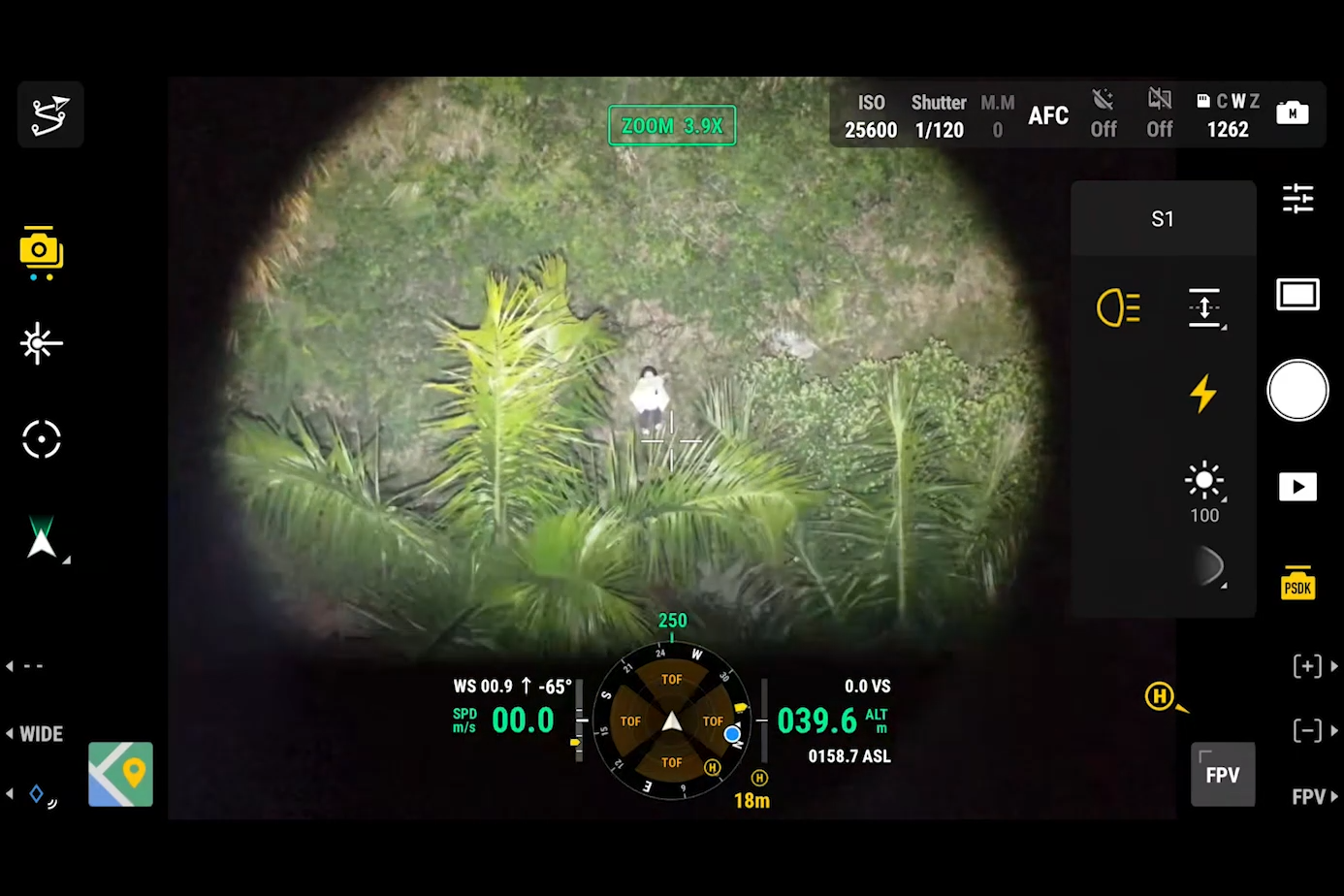
The Matrice 400, equipped with the Zenmuse H30T, brings enhanced thermal capabilities to fire response. Using the new H30T Night Scene mode, fire brigades can now gain valuable insights during low-light operations.
- Reliable multipurpose drone platform easily adapts to the mission needs.
-
Powerful infrared sensor with 1280 × 1024 resolution provides superb thermal imagery.
-
Robust and reliable, payload IP54 graded, allows you to fly when is most needed.
-
Laser range finder to get accurate coordinates of objects up to 3,000 meters range.
-
Enhanced full-color or black-white night vision to easily identify risks.
Drone Platform
DJI Matrice 400
Weight: 9740±40 g (with batteries)
Max Takeoff Weight: 15.8 kg
Max Payload: 6 kg
Max Takeoff Weight: 15.8 kg
Max Payload: 6 kg
Payload And Software
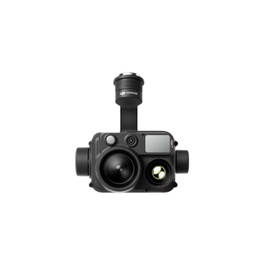
Zenmuse H30T
Wide-Angle RGB Camera: 1/1.3-inch CMOS, 48MP effective pixels
Zoom RGB Camera: 1/1.8-inch CMOS, 40MP effective pixels, 34× hybrid optical zoom
Infrared Thermal Camera: 1280×1024@30fps
NIR Auxiliary Light Illumination Range: Approx. 8m diameter circle@100 m
Laser Range Finder: Max measurement range 3000 m
Zoom RGB Camera: 1/1.8-inch CMOS, 40MP effective pixels, 34× hybrid optical zoom
Infrared Thermal Camera: 1280×1024@30fps
NIR Auxiliary Light Illumination Range: Approx. 8m diameter circle@100 m
Laser Range Finder: Max measurement range 3000 m
Learn more
DJI Pilot 2
Ground control
DJI FlightHub 2
Drone and dock's cloud management system
Workflow
- Mission Execution:
- Fly manually over the affected area looking for hotspots. Switch between infrared and visual views to evaluate the situation.
- Use the Link Zoom feature to zoom in simultaneously with thermal and visual sensors.
- Select a suitable infrared palette and gain mode for conditions at hand.
- Install the IR Density Filter to increase the measurement range of the thermal sensor.
- Get the coordinates of hotspots using the laser range finder and the Pin Point function.
- Share the coordinates with ground teams through the DJI Pilot 2 QR code or DJI FlightHub 2. - Post Mission Documentation:
- Collect the videos and photos captured during the mission through DJI FlightHub 2 to be used as evidence or debrief documentation.